The advantage of aerial shots over other landscape photos is clear. Virtually everything you shoot will be on the same plane. So you won’t have depth of field issues and therefore. And you won’t need to close the iris very much. You can even use much larger aperture values.
Using an f/5.6 type aperture will allow you to select a higher shutter speed. So you can compensate for the shake of the touring plane, moving balloon, etc. and your movement, relative to the static scene, it. Never look for stability by leaning on part of your means of transport. The vibrations or the movement itself will give the opposite effect of what you are looking for.
It’s a good idea to use a standard or wide-angle lens, although there are times when you’ll find it very useful to shoot a shorter shot of a specific element. When it comes to animals, you can use a telephoto lens to capture at least their whole body and not just a few unreadable dots and undefined shapes.
The strength of aerial photography lies in the textures. Use shapes and colors to produce abstract and suggestive compositions. Do not neglect the organization of the elements on the take since it is on this type of photos that you take risks.
Orthophotography and digital photography
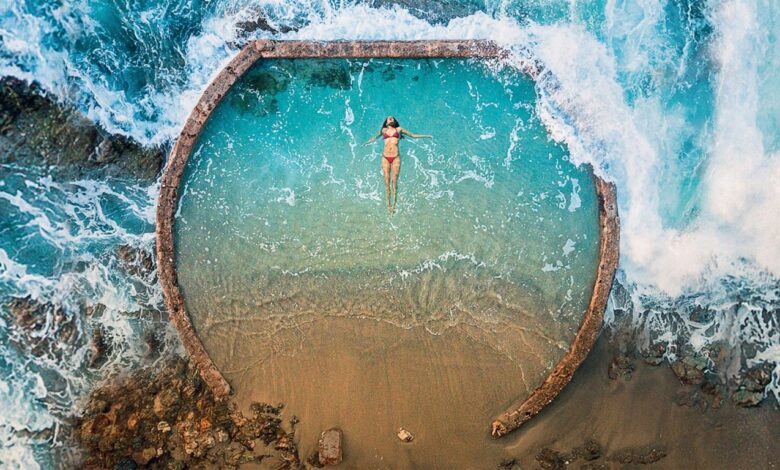
For aerial photography, when the plane of the earth is completely parallel to the plane of the image, this is called vertical photography or orthophotography. In other words, the camera focuses perpendicular to the ground. In vertical photos, the landscape is well defined within the frame and all elements that appear in the image are at the same scale, without information or perspective errors, thanks to a digital correction process called orthorectification.
Vertical shots work with well mapped and other photogrammetric studies. They aim to take precise measurements in the field, to then superimpose them on a construction plan. For example, to check whether there are deviations or whether everything is correct.
Do not confuse aerial photography with orbital photography since the latter refers to images captured at a much higher height using cameras located on satellites in orbit (hence the name) around the earth. or on other spacecraft.
The photos produced in this way cover a much larger area and are normally used for meteorological studies and in the search for natural resources.
Methods to practice aerial photography
By hang glider or paraglider
Always accompanied by a professional who directs it, you will be able to glide with either of these means of transport. So you will also have photo opportunities. But here, you won’t be able to bring large equipment, just your camera and a lens. Check for more prime lenses on dzofilm.com.
Even if the adrenaline of the photographic “duty” invades you, you will have to listen to the instructor constantly to guarantee the safety of the flight. Hang your device securely using its strap. Try to wear it very short and also secure your device using a harness or equivalent system. But above all, protect it to prevent it from suffering a shock on landing. You can get a shockproof case to do this.
On top of a skyscraper
If you have no resources, in some cities you can always climb to the top of one of the tallest buildings in the world, from where you can take aerial photos behind glass. Use a polarizing filter to reduce glare.
The use of drones: an alternative whose success is skyrocketing
With the democratization of action cams (small cameras designed for muscular activities and risky sports), this technology has gradually adapted to photography, so that today there are several devices that allow you to place your camera on a small remote-controlled gyrocopter.
We are of course talking about drones, on which you can install your camera to raise it to the heights. Controlling a drone -or a driverless vehicle- is complex and therefore requires great practice. We advise you not to mount your device on it until you are sure you can land the drone safely. Indeed, if this were not the case, it could end up with equipment reduced to no aerial photos…